| Introduction | Bouvet Island |
|
Background:
|
This uninhabited volcanic island is almost entirely covered by glaciers and is difficult to approach. It was discovered in 1739 by a French naval officer after whom the island was named. No claim was made until 1825, when the British flag was raised. In 1928, the UK waived its claim in favor of Norway, which had occupied the island the previous year. In 1971, Bouvet Island and the adjacent territorial waters were designated a nature reserve. Since 1977, Norway has run an automated meteorological station on the island. |
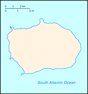
| Geography | Bouvet Island |
|
Location:
|
island in the South Atlantic Ocean, southwest of the Cape of Good Hope (South Africa) |
|
Geographic coordinates:
|
54 26 S, 3 24 E |
|
Map references:
|
Antarctic Region |
|
Area:
|
total: 58.5 sq km
land: 58.5 sq km water: 0 sq km |
|
Area - comparative:
|
about 0.3 times the size of Washington, DC |
|
Land boundaries:
|
0 km |
|
Coastline:
|
29.6 km |
|
Maritime claims:
|
territorial sea: 4 nm |
|
Climate:
|
antarctic |
|
Terrain:
|
volcanic; coast is mostly inaccessible |
|
Elevation extremes:
|
lowest point: South Atlantic Ocean 0 m
highest point: Olav Peak 935 m |
|
Natural resources:
|
none |
|
Land use:
|
arable land: 0%
permanent crops: 0% other: 100% (93% ice) (2001) |
|
Irrigated land:
|
0 sq km (1998 est.) |
|
Natural hazards:
|
NA |
|
Environment - current issues:
|
NA |
|
Geography - note:
|
covered by glacial ice; declared a nature reserve |
| People | Bouvet Island |
|
Population:
|
uninhabited (July 2005 est.) |
| Government | Bouvet Island |
|
Country name:
|
conventional long form: none
conventional short form: Bouvet Island |
|
Dependency status:
|
territory of Norway; administered by the Polar Department of the Ministry of Justice and Police from Oslo |
|
Legal system:
|
the laws of Norway, where applicable, apply |
|
Flag description:
|
the flag of Norway is used |
| Economy | Bouvet Island |
|
Economy - overview:
|
no economic activity; declared a nature reserve |
| Communications | Bouvet Island |
|
Internet country code:
|
.bv |
|
Communications - note:
|
automatic meteorological station |
| Transportation | Bouvet Island |
|
Ports and harbors:
|
none; offshore anchorage only |
| Military | Bouvet Island |
|
Military - note:
|
defense is the responsibility of Norway |
| Transnational Issues | Bouvet Island |
|
Disputes - international:
|
none |
Sources: The CIA World Fact Book and other public domain Internet sites